


| By: Paul S. Cilwa | Viewed: 5/1/2024 |
Page Views: 156 | |
| Topics: #Arizona #FourPeaksRecreationArea #MazatzalMountainWildernessArea | |||
| Photos of a diverse and ecologically rich area, rugged terrain with a mix of desert and highland ecosystems. | |||
The Mazatzal Mountains, a rugged and remote range in central Arizona,
are characterized by a rich geological history and diverse ecology. Geologically,
they feature Precambrian rocks, including the erosion-resistant Mazatzal Quartzite,
and are known for the Great Unconformity, where nearly a billion years of Earth's
history is missing
between the Tapeats Sandstone and older rock units.
Ecologically, the Mazatzals transition from Sonoran Desert shrubland at lower elevations to semi-desert grasslands and up to pine-covered highlands, supporting a wide array of flora and fauna. The range is also home to the Mazatzal Wilderness Area, which preserves over 252,500 acres of this unique landscape.
I've enjoyed every moment spent in this sacred land. I hope you enjoy the photos I've taken, on the following pages.
Bartlett Lake
| By: Paul S. Cilwa | Page Views: 2578 | ||
| Topics: #Arizona #BartlettLake #CentralArizona | |||
| All the photos and stories from my visits to Bartlett Lake, located just an hour or so north of Phoenix. | |||
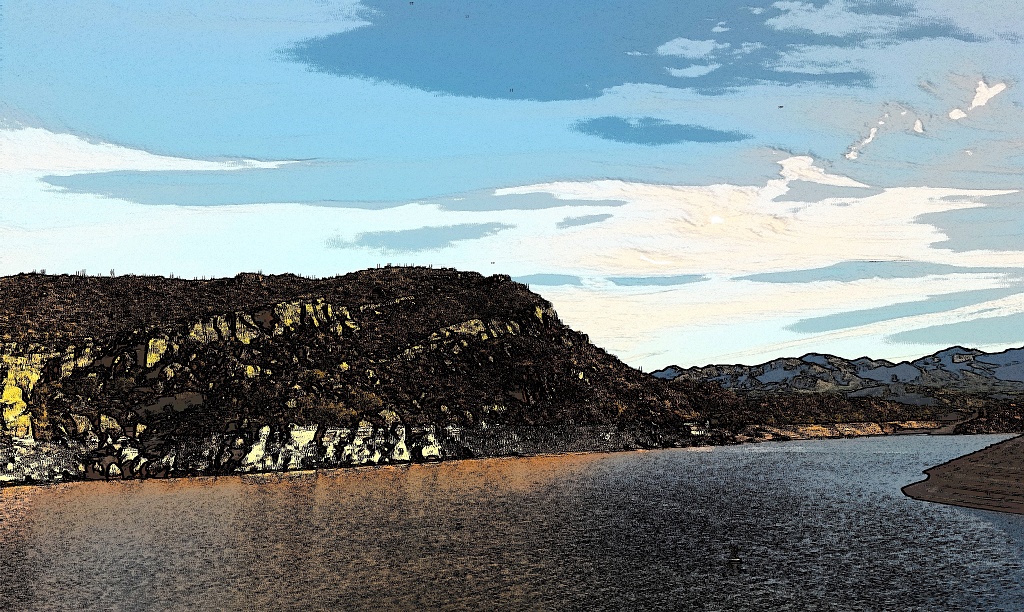
Bartlett Lake, located 48 miles from downtown Phoenix and 17 miles northeast of Carefree, Arizona, is a popular recreation area in the Tonto National Forest. After wet winters, the Bartlett Lake area often has fine displays of spring wildflowers. The facilities at Bartlett Lake are managed by the Forest Service. It's part of the Tonto National Forest and therefore needs a Tonto Forest Pass ($6) per day, whether you are just visiting or camping over night. (But there's no additional charge to camp.)
Read more…
Approaching Four Peaks
| By: Paul S. Cilwa | Occurred: 3/21/2024 |
Page Views: 308 | |
| Topics: #Arizona #FourPeaksRecreationArea | |||
| Photos of my exploration of the Four Peaks Recreation Area. | |||
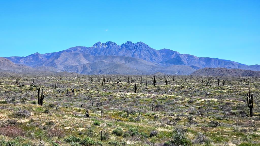
From the eastern half of the misnamed Valley of Phoenix, the great massif at the head of the Superstition Mountains dominates the eastern horizon. It's huge and you can't miss it; it's visible from windows, parking lots, and highways. But soon after you get so used to it you almost stop seeing it, you notice another distinctive mountain to its left.
Read more…
Pine Loop Trail
| By: Paul S. Cilwa | Page Views: 1020 | ||
| Topics: #Arizona #BallentineTrailHead #BeeLineHighway #PineLoopTrail | |||
| All about my adventures on Pine Loop Trail, along Arizona's Bee Line Highway. | |||
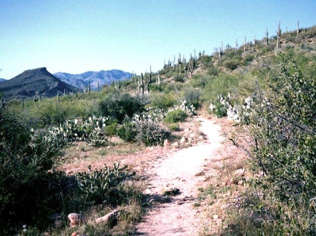
If you'd like to take a stroll among some giant Saguaro cactus and have an afternoon to spend doing it, you can't go wrong with Pine Loop Trail. Located just off state highway 87 (the "Beeline"), just north of Phoenix/Mesa, the trail starts at the Ballantine Trail parking lot. The Ballantine Trail, itself, starts at the other side of the hill, at the far end of Pine Loop Trail, 1½ miles in either direction. But Pine Loop Trail is, itself, a pleasant diversion.
Read more…